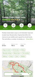
I decided to review an app from the Apple App Store called All Trails: Hike, Bike & Run. This app allows you to discover hiking, biking, and running trails around the world. I was first introduced to this app when I visited Hawaii on a military training exercise. I have now used it in Hawaii, North Carolina, and Virginia, so I am pretty familiar with the free version’s layout and functionality.
Instead of exploring the first layer of the app through screenshots, I have created a screen recording below for your viewing pleasure:Usability:
The app is intuitive and easy-to-use with its swipe and
scroll mechanisms. Additionally, there is a tabular bar located at the bottom
of the screen to switch between displays. From the video, you can see how easy
it is to switch from exploring a trail, planning a trail, recording, seeing your
history, and managing your profile.
The app uses your cellular or Wi-Fi location settings to
determine trails near you. When you open the application, the trails nearest to
your location are populated on the screen. Additionally, you can manually change
the location that you want to look at. Overall, I would rate the usability as
excellent because all of the features are intuitive or easy to figure out.
I am inclined to say that this app has undergone scrutiny since its first inception. The app’s design, functionality, and usability are similar to others, especially social media apps. I think this app has undergone multiple heuristics tests, meaning that the app is tested based on a list of the best practice standards in the community. I think the creators have evolved their design incumbent upon the results of tests against a list of heuristics.
Design:
I think the design of the app is akin to social media apps.
Similar to Twitter, the category for what you want to look at is hosted at the
bottom. With billions of people using various social media platforms on their
devices, it is smart to incorporate those design features into this app. The
map explore option (detailed below) is similar to Apple Maps and Google Maps.
It shows your current location and trails near you. Like other interactive
maps, you can change the layers and overlays to your satisfaction. Most often,
I use the interactive map to find the trails nearest to me. From there, all you
have to do is click the icon on the map, and the app brings up the trail name
and description. You can click on the pop-up or click the heart icon to save
the trail to your “Plan” tab (I think of the Plan tab as analogous to favorites
on a browser toolbar).
Overall, the design is very simplistic and aesthetically pleasing.
The app’s layout is intuitive to a first-time user and even more so for an
experienced user (one that has used social media apps). Among the category
tabs, the keyword search bar, filter list, and list or map display of results,
a person will be able to find the trail they are looking for with ease.
Functionality:
I think the functionality of this app succeeds in its
intended purpose. The main function is to find trails worldwide, and they
incorporated a list and map utility (based on location services) to quickly display
that information. Additionally, they created a multitude of filters for the
user to specify for their search. Added functions include connecting with
friends, sharing hiking trails, sharing activity, writing reviews, uploading
photos and videos, recording activity, creating favorites, in-app support,
account support, and various arrays of display functions. One function I
noticed for the first time is that you can change from metric to imperial units
of measurement. I was using kilometers the whole time!
Recommendations:
1. 1. I would probably leave the “Browse by activity”
option in the filters menu instead of adding it to the main screen. This would
allow for less clutter when searching through trails.
2. 2. There is an auto-sync function when you move
around in the app or re-open it. When there is no service, the re-sync displays
a blank map and can make it hard to figure out where to go when you are on the
trail. However, you can download maps for offline navigation with the pro
version.
3. 3. You are able to connect an Apple Watch or Garmin
to the app; however, this only allows the device’s recorded metrics to be
displayed in the app. Personally, the only reason I would connect my watch to
the app would be to get a map display or directions for the trail on my wrist.
Currently, this functionality does not exist.
Overall, I had to really dig deep to find anything
aesthetically unpleasing or flaws in this app. The developers did an excellent
job creating the app and continue to do an excellent job maintaining it.
Find the All Trails App at the Apple and Google Play Stores:
AllTrails: Hike, Bike & Run on the App Store (apple.com)
AllTrails: Hiking, Running & Mountain Bike Trails - Apps on Google Play


No comments:
Post a Comment